
LANDHOLDER RESOURCE GUIDE
Identifying Your Framework
Before commencing any regeneration or revegetation works, it is necessary to obtain a clearer understanding of your current framework. The term ‘framework’ refers to the existing woodland present on or adjacent to your property. It helps to generate some simple maps using publicly available tools (Google Earth, QGIS, SixMaps) that illustrate the property boundaries along with any important infrastructure such as internal and external fencelines, waterways, dams, contour topography, and roads (Figure 1). Overlaying other landscape features such as soil type, surface geology, and any pre-surveyed vegetation types can also be useful for better understanding your site. Identifying current vegetation communities can be be challenging but is an essential requirement for planning any rehabilitation works. There are many free tools and resources available in the public domain to help develop maps of your site, these include Google Earth, QGIS, SixMaps, SEED environmental data, or aerial imagery obtained from local councils.
Figure 1: An example of a simple basemap generated in QGIS. Green shaded polygons indicate pre-existing woodland areas with broad vegetation type classification obtained from pulically available datasets (Benson & Ashby, 2000)
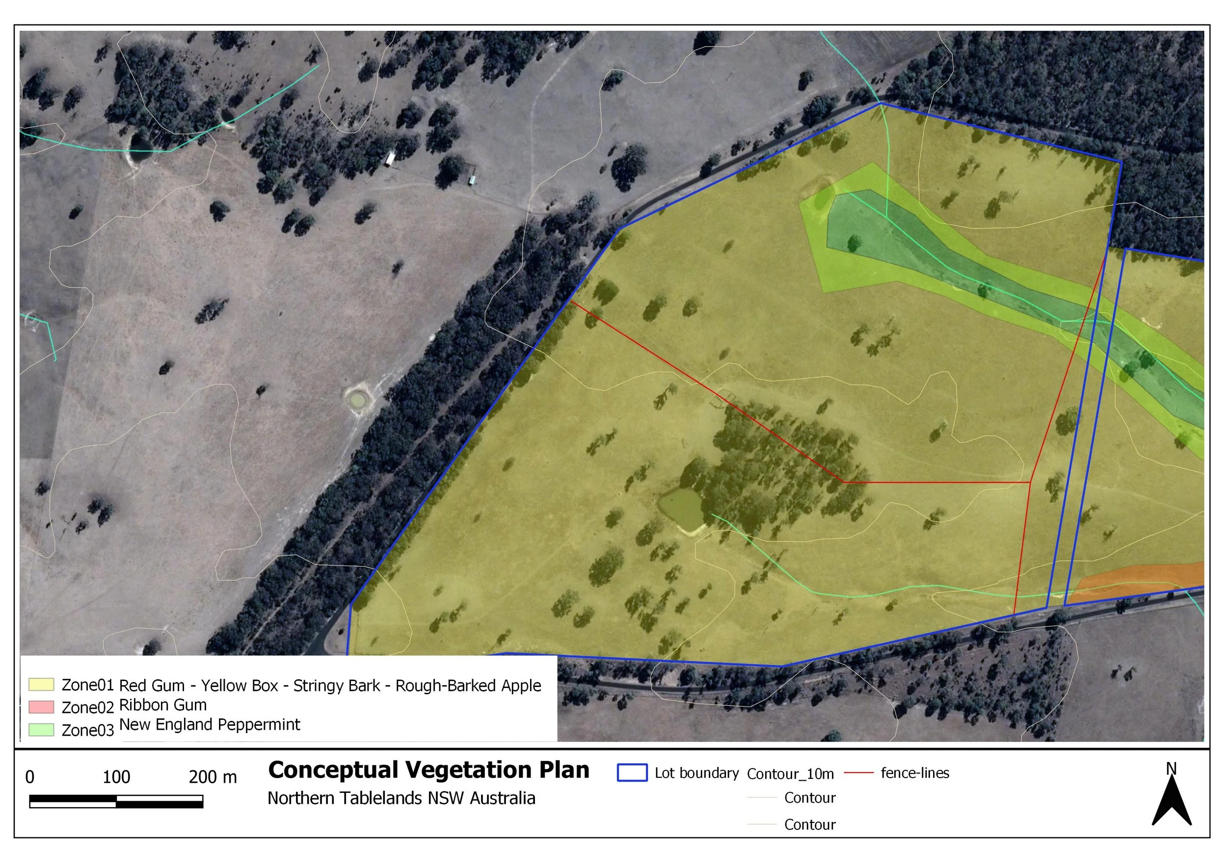
While broad vegetation classifications can be useful for obtaining an initial simplified overview of the ‘likely’ vegetation communities present on your property, it is always necessary to gain a more detailed understanding of your woodland by physically identifying your trees. Identifying vegetation can be challenging but there are a wealth of resources available online and in print that can help you with this task. After walking your land you are likely to generate a more detailed understanding of the species of trees present, with this information it is possible to develop a more detailed map of broad vegetation types. It can be helpful to break your landscape up into zones to broadly apply vegetation classification to areas that are currently without vegetation (Figure 2).
References
Benson, J.S. & Ashby, E.M. (2000) Vegetation of the Guyra 1:100 000 map sheet New England Bioregion, New South Wales. Cunninghamia 6(3): 747-872
Goldney, D. C., & Wakefield, S. (1997). Save the bush toolkit. Environmental Studies Unit, Charles Sturt University.
Rawlings, K., Freudenberger, D., & Carr, D. (2010). A guide to managing box gum grassy woodlands. Commonwealth of Australia.
McIntyre, S., McIntyre, S., McIvor, J. G., & Heard, K. M. (Eds.). (2004). Managing & conserving grassy woodlands. CSIRO PUBLISHING.